")
13th_Europe_Report -- 14_1919_aerial_view.jpg
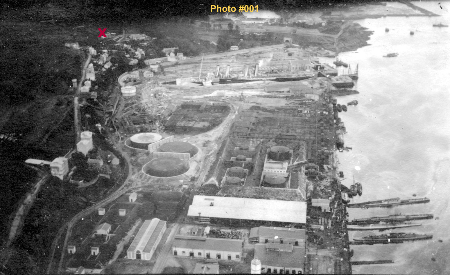
Covering a similar area as the 2014 Google Satellite view is this 1919 aerial
view. Again, thanks to Monique and Alian, we were sent links to these
precious historic photos. As stated in their e-mail from Brest, "The
aerial photos were taken in 1919. They were in boxes, with other photographs on
paper or glass. No one knew their existence until a few years ago, when the
French Research Institute for Exploitation of the Sea (in Brest) had to move
those boxes to another part of their offices. It was a fantastic discovery."
To access the .pdf web report on this find (in French, but with great historical
photos)
CLICK HERE. The interactive web site for 1919 aerial photos can can be
accessed with patience and preferably a little understanding of French by
CLICKING HERE.
Each red "X" on this page corresponds to those on the previous page. The WWI US Naval Air Station was in existence when these aerial photos were taken and is shown here circled in red. The 2 Laninon dry-docks that were constructed in 1910 show prominently in the upper center of this 1919 photo, as well as the Google Satellite view from 95 years later. For a view of this dry-dock area from a WWI observation balloon from Harry StClare's album, CLICK HERE.
First |
Previous Picture |
Next Picture |
Last | Thumbnails